MARHIS (Maritime Aggregated Hydraulic Infrastructures) is a distributed ICTS whose objective is to increase the efficiency and capacity of Spanish numerical, experimental and field facilities in coastal, port and offshore engineering. It consists of the following facilities:
Large Maritime Engineering Tank of Cantabria
It is managed by the Foundation Institute of Environmental Hydraulics and has advanced facilities for the generation of wave, current and wind, as well as the ability to perform tests with a depth equivalent to 1000 m on a 1/100 scale.
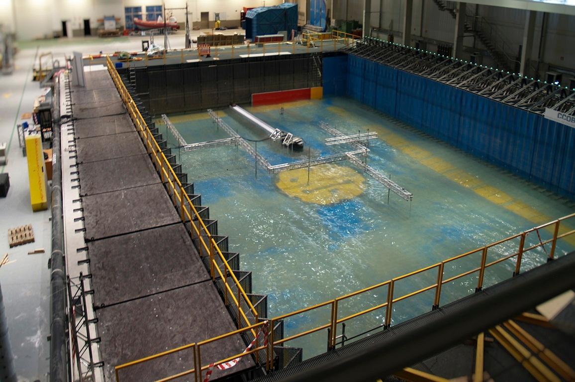
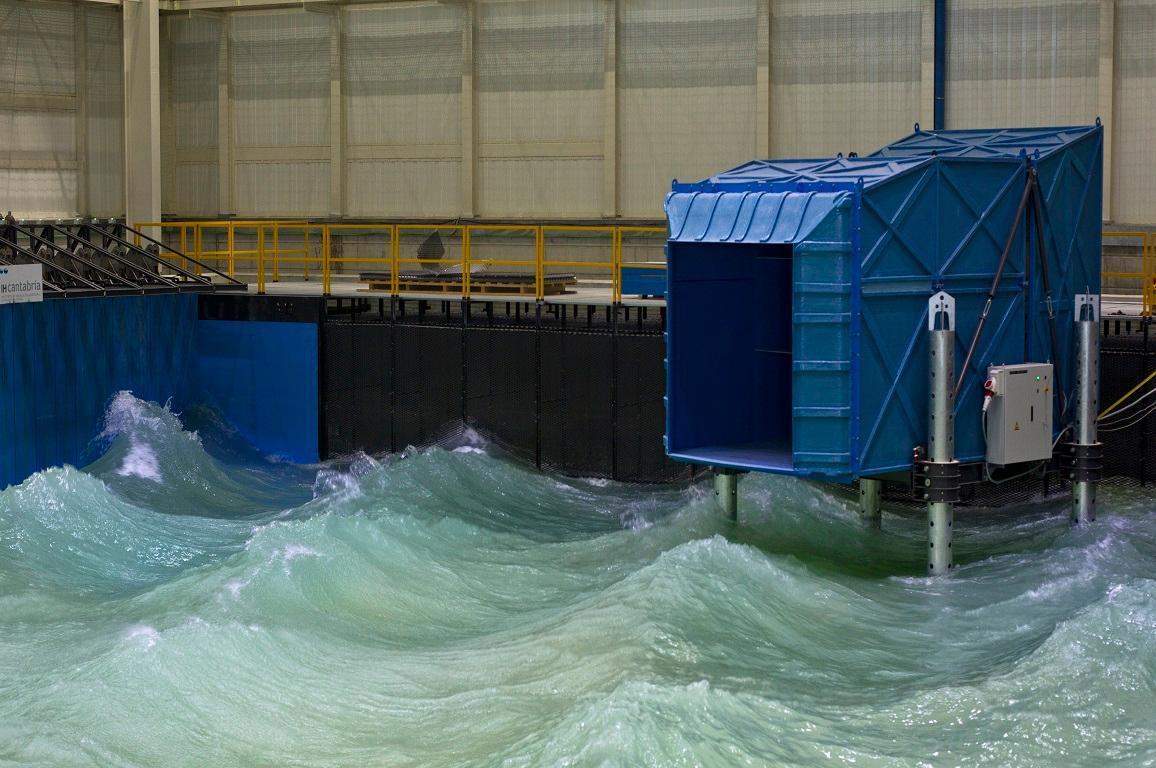
It has 2 directional wave tanks with current and wind generation capacity, 3 wave-current channels, 1 variable slope current channel, 1 tank for the study of hypersalin discharges, as well as a river model construction area. The Great Marine Engineering Tank stands out, with a width of 44 m, 30 m of variable length and depth (up to 3.4 m), with multidirectional wave capacity, omnidirectional current and wind. The CoCoTsu tsunami wave channel (56 m in length, 2 m in width and maximum variable height of 2.5 m) should also be noted.
Integrated Coastal Infrastructures for Experimentation and Simulation
It has facilities in different locations of the coastal area of Barcelona that allow research and engineering activities in the maritime field. The main facilities are the large-scale wave channel ICES and the small-scale channel ICES.
The Marine Field Observation Laboratory has a network for the collection of meteorological and oceanographic data from the Gulf of Roses and the Ebro Delta.
The Pont del Petroli Coastal Observatory is a trousers that extends 250 m offshore. It is the first installation in micro-tidal conditions in the European Union.
Both laboratories are complemented by the High Resolution Numerical Modeling Laboratory.
BIMEP
BiMEP is an offshore infrastructure for the research, demonstration and operation of marine energy harvesting devices. It was founded in July 2015 and is managed by the public company BIMEP S.A., involved by Ente Vasco de la Energía (EVE) and the Institute for Diversification and Energy Saving (IDAE).
It has a restricted navigation area of 5.3 Km2 in open sea with perimeter beaconing provided by seven nautical signage buoys. The devices located in the test area are grounded by four submarine electrical cables with a total evacuation capacity of 20MW additionally equipped with optical fiber. It also has a 24-hour navigation support system, an oceanographic buoy with data measurement since 2008 and offices for technical management.
Center of Hydrodynamic Experiences of El Pardo
The Center of Hydrodynamic Experiences of El Pardo depends on the Subdirectorate General of Naval Systems (SGSN) of the National Institute of Aerospace Technique (INTA). It was created in 1928 by the Spanish Navy and is dedicated to research and experimentation in the field of hydrodynamics, mainly in the field of shipbuilding.
It has a calm water channel, a cavitation tunnel and a ship dynamics laboratory.
PLOCAN-TS
The test bench of the Canary Islands Ocean Platform (PLOCAN), managed by the PLOCAN Consortium (co-financed equally by the General Administration of the State and the Government of the Autonomous Community of the Canary Islands), is located in the open sea in the municipality of Telde (northwest of the island of Gran Canaria), in an area of 23 km2 reserved for technical scientific experimentation.
